 Missoula to Boise
 along the Bitterroot Mountains, Salmon River Scenic Byway, and Ponderosa Pine Scenic Byway was also a 380 mile day. Our stops were in Lolo for fuel, Lost Trail Pass, Chief Joseph Pass, Salmon, Challis for lunch, Stanley for fuel, Lowman for cold ones, and a final butt break at Mores Creek Summit enroute to Boise.
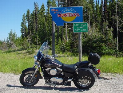
 Lost Trail Pass
 was our first butt break after getting fuel in Lolo, and has a small visitor center, and well equipped restrooms.
 Salmon River Scenic Byway
 is the route we followed from Lost Trail Summit to Stanley.
 Lost Trail Summit
 on Hwy 93 has steep, low-speed twisties on both sides. This pic was taken at the northeast jct to Hwy 43.
 Chief Joseph Pass
, on the Continental Divide, is about a mile east of Lost Trail Pass via Hwy 43 to Big Hole Nat'l Battlefield and Wisdom, MT.
 Lower Stanley.
 Man, had to pull over just outside town at the last minute for this magnificient view of the Sawtooth Mountains and Salmon River. Jack, who was ahead of me, can be seen riding back to the turnout here.
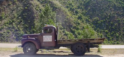 Lowman.
 This old International flatbed truck is parked next door to the Haven Cafe. We stopped here for refreshments (was a very hot day) after parking in the shade next to a '76 BMW R90 and a couple of DynaGlides from Northern Idaho.
 SH-21
SH-21 running south from Lowman to Idaho City is a very challenging route. This shows the northern half of those tight twisties.
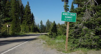 Mores Creek Summit
 where we had our last butt break before riding non-stop to my digs in Boise, is located roughly halfway between Lowman and
Idaho City.
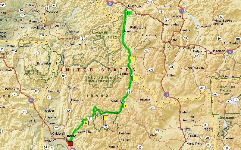 Missoula to Boise along the Bitterroot Mountains, Salmon River Scenic Byway, and Ponderosa Pine Scenic Byway was also a 380 mile day. Our stops were in Lolo for fuel, Lost Trail Pass, Chief Joseph Pass, Salmon, Challis for lunch, Stanley for fuel, Lowman for cold ones, and a final butt break at Mores Creek Summit enroute to Boise.
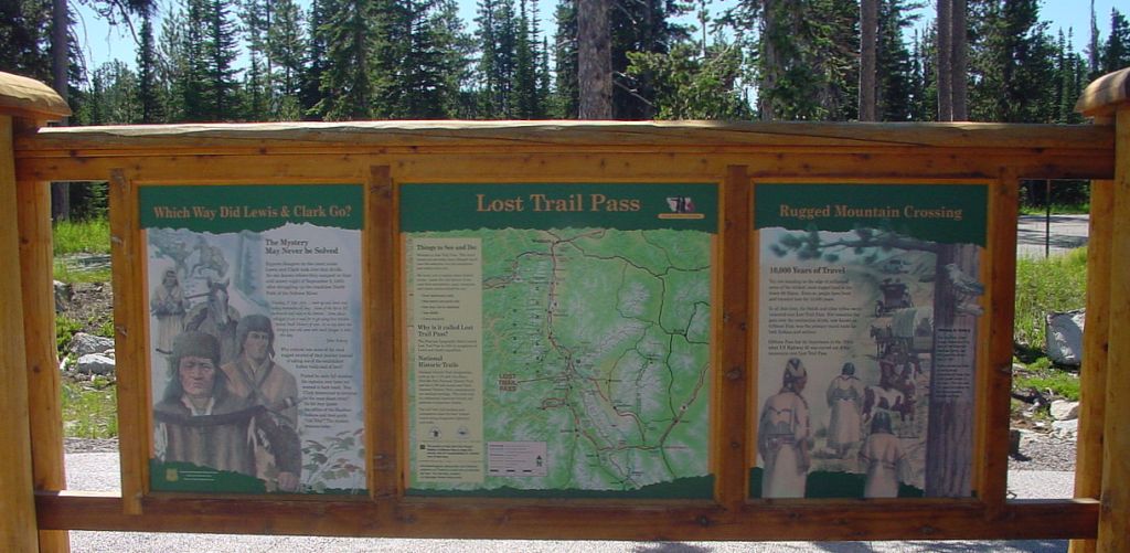 Lost Trail Pass was our first butt break after getting fuel in Lolo, and has a small visitor center, and well equipped restrooms.
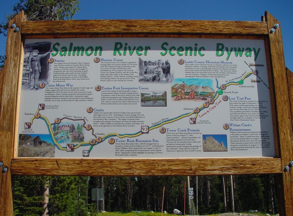 Salmon River Scenic Byway is the route we followed from Lost Trail Summit to Stanley.
 Lost Trail Summit on Hwy 93 has steep, low-speed twisties on both sides. This pic was taken at the northeast jct to Hwy 43.
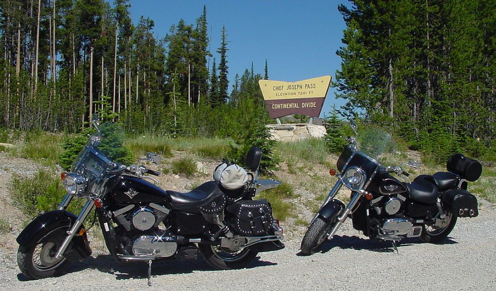 Chief Joseph Pass, on the Continental Divide, is about a mile east of Lost Trail Pass via Hwy 43 to Big Hole Nat'l Battlefield and Wisdom, MT.
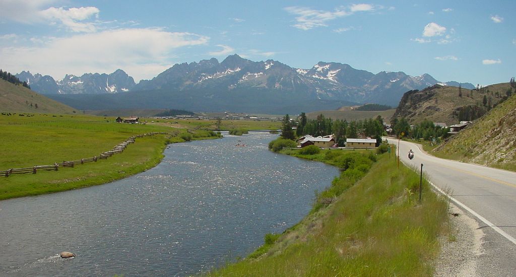 Lower Stanley. Man, had to pull over just outside town at the last minute for this magnificient view of the Sawtooth Mountains and Salmon River. Jack, who was ahead of me, can be seen riding back to the turnout here.
 Lowman. This old International flatbed truck is parked next door to the Haven Cafe. We stopped here for refreshments (was a very hot day) after parking in the shade next to a '76 BMW R90 and a couple of DynaGlides from Northern Idaho.
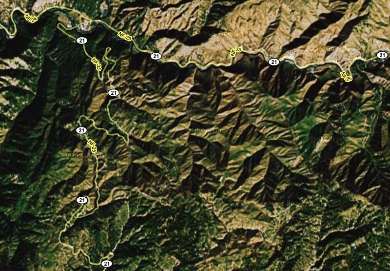 SH-21 running south from Lowman to Idaho City is a very challenging route. This shows the northern half of those tight twisties.
 Mores Creek Summit where we had our last butt break before riding non-stop to my digs in Boise, is located roughly halfway between Lowman and Idaho City.

1 comment:
My cousin and I are meeting in Boise the end of June 2008 where we will depart for a family reunion in Missoula. After seeing your photos and the absolutely breathtaking views, I am convinced though not an easy route with very winding roads, it is the more scenic and enjoyable. Thanks for sharing them.
Post a Comment