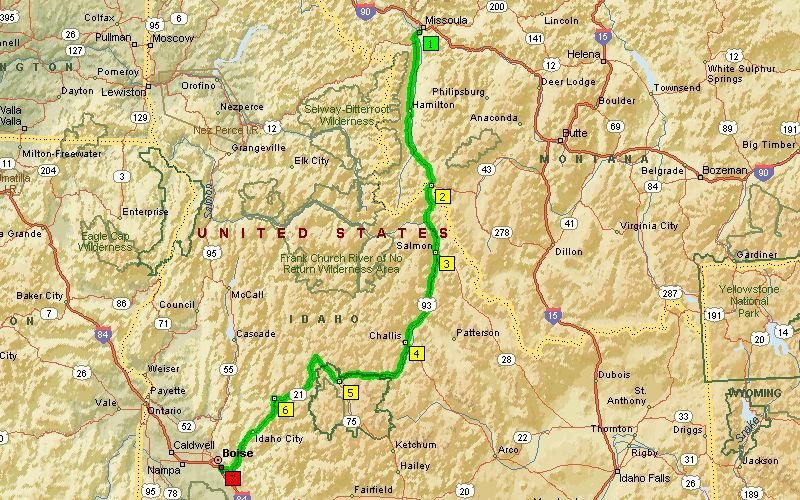
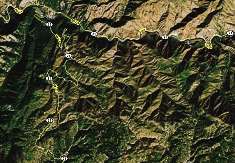
Boise to Missoula
 is a 380 mile ride via the
Payette River & Northwest Passage Scenic Byways over Lolo Pass.
 Payette Lake
 at the southwest side in McCall by the public restroom facility. Do you suppose the little boy cried fowl? ;^)
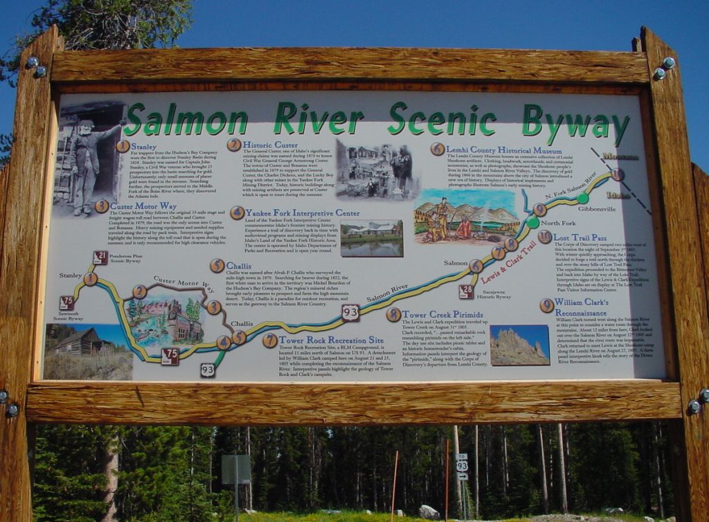
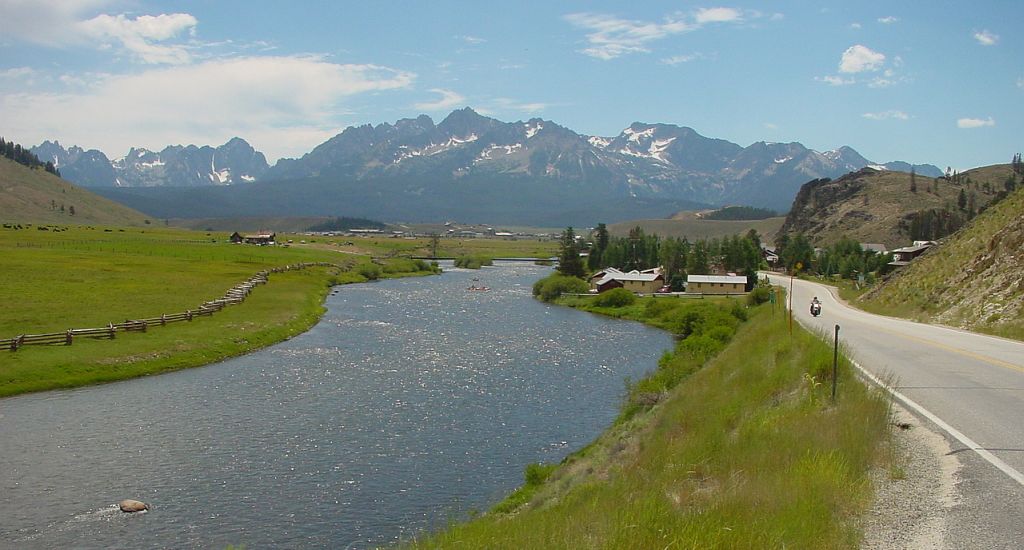
 Salmon River
 facing north from Big Salmon River Rd bridge in Riggins where we stopped for fuel.
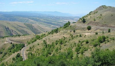 White Bird Hill
 with southeast view of Old Highway 95 winding downhill towards Grangeville.
 South Fork Clearwater River
 just past the junction of Mt. Idaho Grade Rd and SR-14 going east towards Elk City.
 Kooskia
 is where we grabbed lunch at the Rivers Cafe (good food and service!) after gassing up at the nearby Conoco.
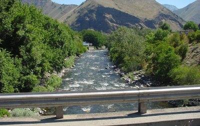
 Lochsa River
 from bridge on Selway Rd by the Three Rivers Resort in Lowell where the Middle Fork Clearwater River joins the Selway River and Lochsa River.
 Selway River
 wanders southeast from the Selway Rd bridge in Lowell. Could feel the bridge shuddering as vehicles drove over it. =8^O
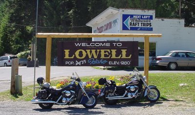 Lowell
 was a busy little town as it has fuel, convenience store, cafe, and whitewater rafting trips. Quite a few motorcyclists stopped here.
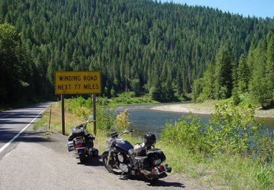 Winding Road Next 77 Miles
 sign is located just east of Lowell alongside the Lochsa River. Photos of this road sign have been posted by many motorcyclists all over the internet.
 Lochsa River
 has quite a few bridges, and this wooden one west of Powell is strictly for pedestrians headed towards the trailhead.
 Lochsa River
 from the wooden bridge facing east. Was on this same bridge back in September of 2003 with Kurt and Kyle.
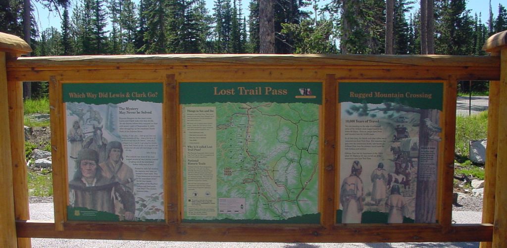
 Lolo Pass
 is at an elevation of 5235' and is right at the Idaho/Montana state line.
 Lolo Pass
 sign on exterior wall of the Visitor Center with Montana to the east and Idaho to the west.
 Lolo Pass Visitor Center
 is located in a very serene area, and has large, comfortable public restrooms. :)
 Missoula County, Montana
 - guess we're not in Idaho anymore, eh? We followed that winding road east downhill to Lolo Hot Springs.
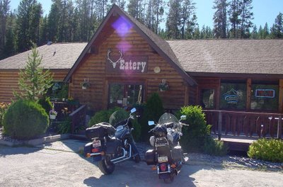 Lolo Hot Springs Resort
 has this eatery and saloon where we celebrated our arrival in Montana with a couple of Moose Drools on tap before riding out to our Super 8 motel in Missoula for the night.
 Boise to Missoula is a 380 mile ride via the Payette River & Northwest Passage Scenic Byways over Lolo Pass.
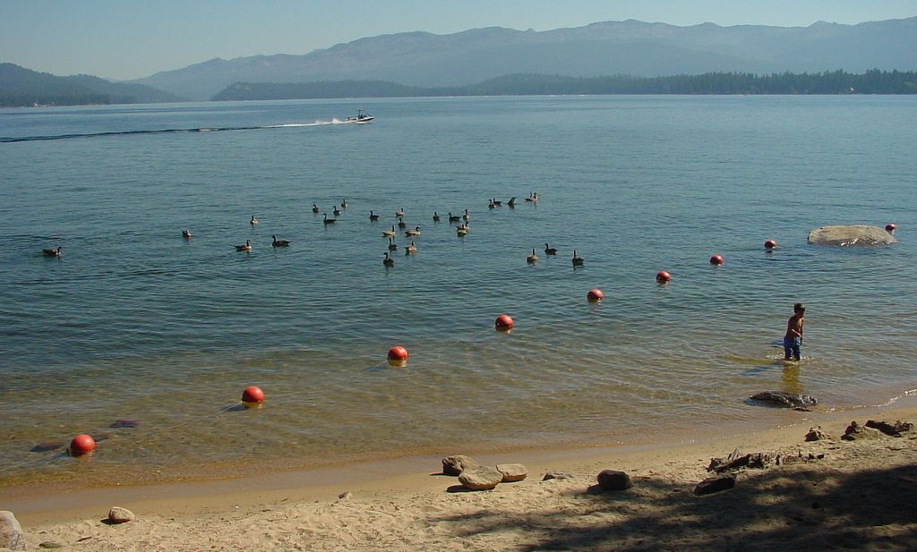 Payette Lake at the southwest side in McCall by the public restroom facility. Do you suppose the little boy cried fowl? ;^)
 Salmon River facing north from Big Salmon River Rd bridge in Riggins where we stopped for fuel.
 White Bird Hill with southeast view of Old Highway 95 winding downhill towards Grangeville.
 South Fork Clearwater River just past the junction of Mt. Idaho Grade Rd and SR-14 going east towards Elk City.
 Kooskia is where we grabbed lunch at the Rivers Cafe (good food and service!) after gassing up at the nearby Conoco.
 Lochsa River from bridge on Selway Rd by the Three Rivers Resort in Lowell where the Middle Fork Clearwater River joins the Selway River and Lochsa River.
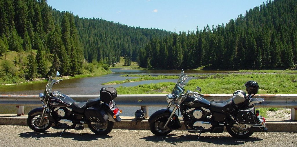 Selway River wanders southeast from the Selway Rd bridge in Lowell. Could feel the bridge shuddering as vehicles drove over it. =8^O
 Lowell was a busy little town as it has fuel, convenience store, cafe, and whitewater rafting trips. Quite a few motorcyclists stopped here.
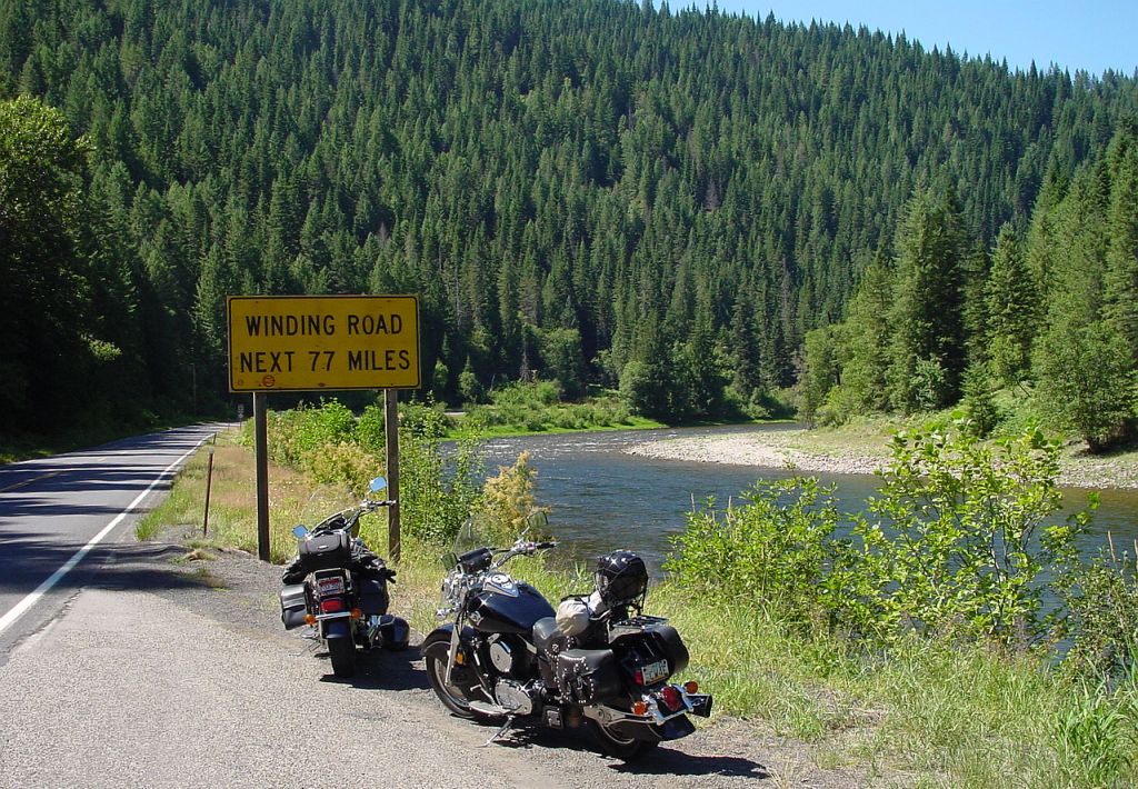 Winding Road Next 77 Miles sign is located just east of Lowell alongside the Lochsa River. Photos of this road sign have been posted by many motorcyclists all over the internet.
 Lochsa River has quite a few bridges, and this wooden one west of Powell is strictly for pedestrians headed towards the trailhead.
 Lochsa River from the wooden bridge facing east. Was on this same bridge back in September of 2003 with Kurt and Kyle.
 Lolo Pass is at an elevation of 5235' and is right at the Idaho/Montana state line.
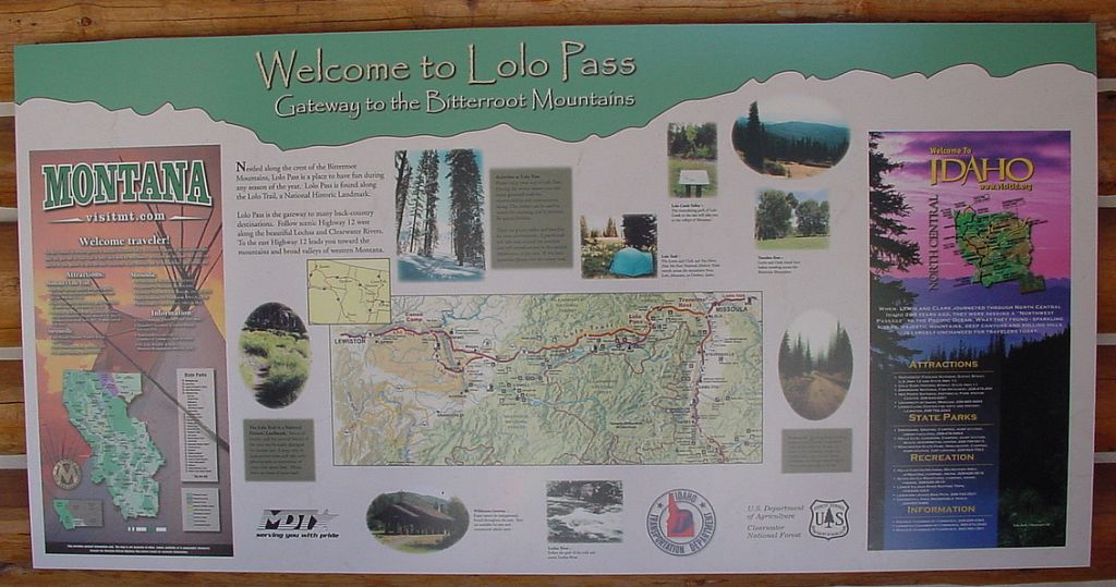 Lolo Pass sign on exterior wall of the Visitor Center with Montana to the east and Idaho to the west.
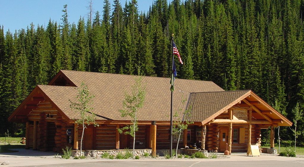 Lolo Pass Visitor Center is located in a very serene area, and has large, comfortable public restrooms. :)
 Missoula County, Montana - guess we're not in Idaho anymore, eh? We followed that winding road east downhill to Lolo Hot Springs.
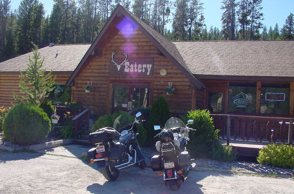 Lolo Hot Springs Resort has this eatery and saloon where we celebrated our arrival in Montana with a couple of Moose Drools on tap before riding out to our Super 8 motel in Missoula for the night.